
Over the last ten years, Wicklow Uplands Council has initiated and participated in a number of projects to improve and manage the recreational use of the Wicklow countryside
In the early stages this work involved projects to improve access for recreational users, the development of policy to support sustainable recreation activities and the promotion and development of the Wicklow trails network. Full details on these activities can be found on our ‘Outdoor Recreation’ project page.
Most recently Wicklow Uplands Council has taken an increasingly active role in the development of new trails. These new trails are being developed strategically to provide links to and from public transport facilities with the existing trail network. Providing greater access to the upland trails network encourages more independent visitors to the region who will stay longer and boost local the local economy.
Wicklow Uplands Council’s trail development projects are done in partnership with landowners, local community groups and stakeholder organisations. The partnership approach ensures the sustainability of the trails and encourages local communities to take ownership of the routes.
The Uplands Council has been involved in the development of four trails to date; The Avonmore Way, The Sugarloaf Way, The Bray Head Loop and The Belmont Way.
More information on those routes and their development are available in the links below.
The Sugar Loaf Way
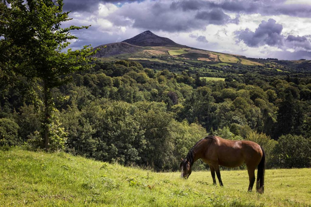
The ambitious vision to develop and map a series of walks on designated trails that will take visitors and locals from Bray DART / Bus Station to Rathdrum train station is a step closer with the recent development of The Sugar Loaf Way. Taking in Kilmacanogue, Roundwood, Annamoe, Laragh and Rathdrum, the Sugarloaf Way will one day form part of an extensive trail through some of the most beautiful scenery in Ireland. The development of the trail was a huge team effort.

The Avonmore Way
The Avonmore Way is an important and strategic route in Wicklow as it provides a pedestrian link with train and bus services in Rathdrum to Laragh. The development of the trail has been undertaken by Wicklow Uplands Council in partnership with Coillte, NPWS, County Wicklow Partnership, private landowner Lucy Morgan, Rathdrum Parish and St Lawrence O’Toole Diocesan Trust, the Parish Committee for Clara Vale Church, Laragh Development Association and Rathdrum Tidy Towns Association.

The Bray Head Loop
The Bray Head Loop is a 5.5km route and offers spectacular views of Bray, North East Wicklow, Dublin Bay and the Irish Sea.
If starting from the Vevay Road, go to the Wilton Hotel roundabout and look for the entrance to the woodland, which is located just beside Bus Stop 4208 – Briar Wood. A map board for the trail is located just inside the gate and can be seen from the roadside. The route is marked with red arrows.

The Belmont Way
The Belmont Way is a 5.5km route that offers a varied, and at times, challenging walk, through some of north Wicklow’s most interesting landscape that includes native woodland, farmland and the shoulder of The Little Sugarloaf and its commanding views.
As a liner route it can be enjoyed from either direction. Sitting neatly between the Bray Head Loop and the Sugar Loaf Way, the trail also forms a central section of the new Wicklow Uplands Way allowing for a longer, more vigorous challenge when combined with either or both options (please see the video below for more on these connected trails).